The
beautiful island of Langkawi is blessed with blue seas, white sand beaches and
emerald forests. And although it is not really noted for its waterfalls, it
does have a trio which can make for a welcome break from seaside activities.
These waterfalls may not be particularly impressive during the dry season, but
come in the rainy months, and it is a very different story.
The
most famous of the waterfalls is Telaga Tujuh, a.k.a. the Seven Wells, followed
by the Temurun waterfall, both located in the Machinchang area. The third,
lesser known waterfall is at Durian Perangin.
 |
| Durian Perangin falls. |
Durian
Perangin appears to be named after that famous thorny fruit, the Durian.
Perhaps there are durian trees in the area, hence the name? Located on the northern slopes at the base of
the Gunung Raya, which is the tallest mountain in Langkawi, the access to the
site is easy if you have your own transport. From the main town of Kuah, head
north towards Tanjung Rhu on Route 112 (Jalan Ayer Hangat). After about 18km
along this road, you will notice a signboard pointing to the left to Durian
Perangin. Take the left and after about a further 2km you will reach the
carpark of the falls.
Park
your car here, and walk towards the entrance to the falls. There are a couple
of stalls here, selling food or souvenirs and snacks.
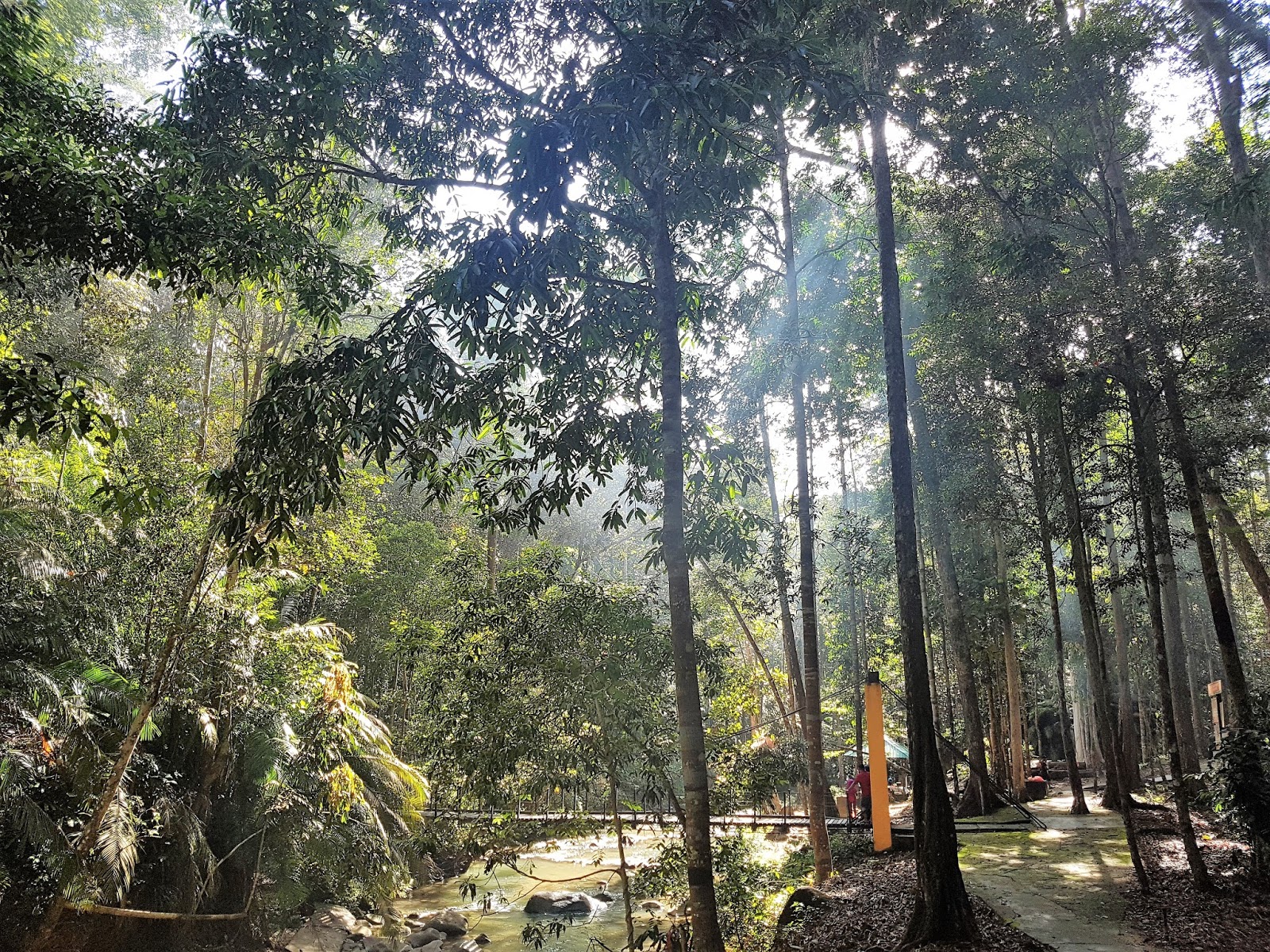
Once
passed these stalls, you will see a well-maintained park. Timber boardwalks,
shelters and walkways line both sides of a fast flowing stream.
 |
| Timber boardwalks and shelters line the bank of the stream. |
A suspension bridge crosses the stream, which you can cross to get to the public toilets on the other side.
 |
| Suspension bridge. |
Walking
up the pathway along the stream is pleasant, as you hear the sounds of the fast
flowing water rushing pass. The water here is shallow, and suitable for kids to
take a dip.
The
path ends at another bridge, which then loops back to the front on the other
bank of the stream. Next to the bridge is another shelter. Both the bridge and shelter
face a nice swimming hole which is fed by the first waterfall.
 |
| View of the first swimming hole from the 2nd Bridge. Note more steps leading upwards to the right. |
On the right of this first swimming hole, you will notice steps leading up the hill. Up to this point, the walking has been easy. To climb up these steps would require a bit of fitness.
 |
| View of the first waterfall from the side. |
As you climb up these steps, you will notice the waterfall gushing alongside the route. Appearances can be deceiving, the waterfall is much taller than it seems from below.
 |
| The waterfall hidden in the undergrowth. |
The climb up the hill may require a few stops if you are particularly unfit, but otherwise it is not too difficult and the is clearly marked. It should not take too long to reach the top.
 |
| At the top, the river cascades over the rock to form the waterfall below. |
Once the steps end, you will find yourself overlooking another pool, fed by another waterfall coming down from the top. This waterfall has a taller drop than the one below, and the pool is larger.
You can clamber down the rockface to get to the pool below. When we there on a normal weekday, there were only three other people around, and the whole setting was indeed calm, soothing and relaxing.
 |
| The 2nd waterfall and pool. |
A nice place to relax and take in the environment. Our only regret is that we didn't bring our swimmers to jump in and take a dip in the cool mountain water.